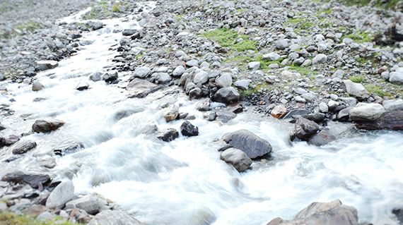
Hampta Pass Trek
Hampta Pass Trek

Hampta Pass

Manali, Himachal Pradesh INR 10,000
+(5% GST)per pax (Manali to Manali)

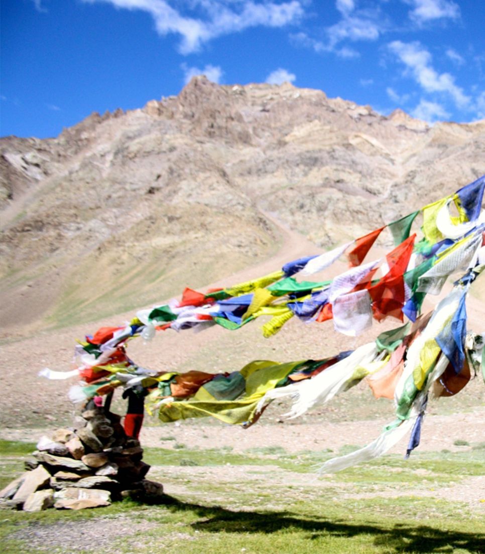
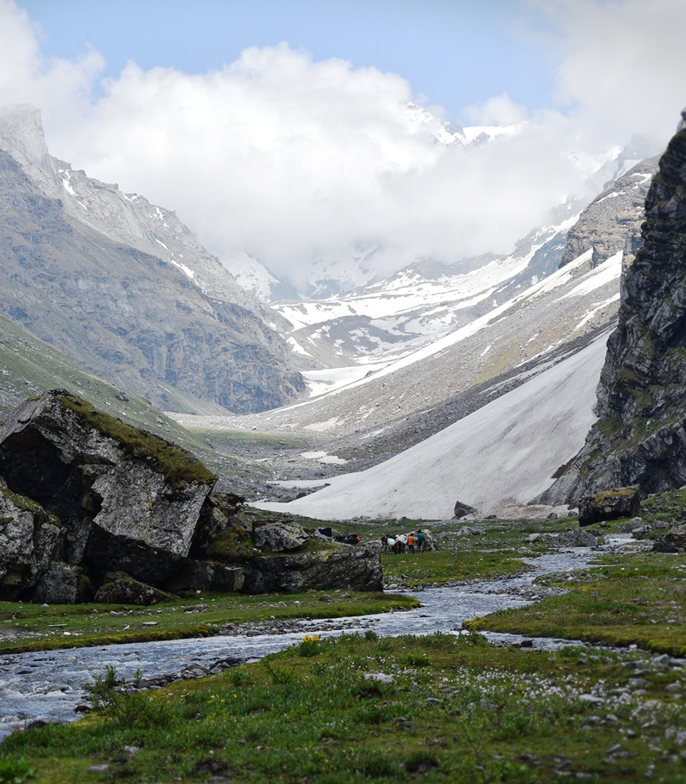
Hamta Pass lies on the Pir Panjal range in the Himalayas. It is a small corridor between Lahaul and Kullu valley of Himachal Pradesh, India. Hamta village is located below Sethan village and from there it got its name Hamta Pass. It is also known to be the road to heaven, as it was the route taken by Yudhishthira on his accent to heaven, The Hamta Pass is also named after the Rishi that meditated there named Hamta Maharishi. This pass is frequently used by shepherds of lower Himalayan region, seeking for high altitude grassland in the dry cold desert of Lahaul during summer time. Numbers of wild flowers and herbs grow at the altitude between 3000 to 3800 m. Vertical rock walls, water falls, hanging glaciers, tiny lakes, peaks rising above 6000 m are main characteristics of this trek.

  • Height of the Trek 14,350 Feet
  • Vacation Style 12-40 Years of Age
    Camping Trek
  • Activity Level Easy to Moderate
    4/10
  • Group Size Medium Groups
    15
  • Duration 6 Days
  • Km One Way
    30 Km
Whats included in this tour Items that are covered in the cost of tour price.
  • All breakfasts, lunches and dinners during trek only (VEG)
  • Transport from Manali-Manali Base Camp & Chandratal-Manali
  • All accommodation during trek only
  • All campaign equipments
  • Medical Kit
  • Professional Trek Leaders (Experienced Guide/Staff)
  • All forests permits
Whats excluded in this tour Items that are not covered in the cost of tour price.
  • Travel insurance and other emergencies
  • Mules (A Hybrid Animal) to carry personal luggage
  • Last Day Accommodation & Dinner is not included
  • Single room accommodations
  • Hard Drinks (This also includes undistilled fermented beverages)
  • Photography accessories like cameras etc.
  • Things To Carry
    • 1 Pair of Thermal
    • 3 Pair of Socks + 1 Pair of woolen socks
    • 2 Pair of Hand Gloves (Water Proof & Fleece material)
    • Sun Cap
    • Woolen Cap
    • Neck Warmer (Scarf/Buff)
    • 2 Quick Dry Full Sleeves (T-Shirt)
    • 1 Full sleeves Fleece
    • 1 Wind Proof Jacket (windcheater/Heavy Jacket)
    • 2 Track Pants (No Cotton or Jeans)
    • Sun Glass
    • Sun scream, Lip balm, Moisturizer
    • Torch
    • Trek Pole
    • Trekking Shoes (No Sports shoes or Woodland shoes)
    • Poncho ( The Gear used to protect from Rain)
    • Day pack (Small one)
    • Back Pack 60 ltr (+ Rain cover)
    • 2 Water Bottles
    • Toilet Paper & Wet Wipes
    • Hand Sanitizer
    • Antibactial Powder
    • Tooth Brush
    • Quick Dry Towel
  • Medicines To Carry
    • Crocin (1Strip)
    • Disprine (1 Strip)
    • Lomotive (1 Strip)
    • Digene (1Strip)
    • Guaze
    • Dettol
    • Band Aid - Qty 5
    • Neusphorine Powder
    • Betadine Tube
    • Vomistop/Avomine (Motion Sickness Tablet)
  1. Day 1 Manali to Manali base camp (Katerni) - 8 km | 6732 Ft

    The fascinating Bhrigu Lake Trek commences from the city of Manali in Himachal Pradesh. The destination for the day is to reach the first campsite, the Katerni evening time. Onward journey from Manali is scheduled at 2pm so travelers are requested to reach the destination by morning time. In Manali, there are several prominent sightseeing spots like Hadimba Devi Temple, Tibetan Monastery, Mall road etc since it is one of the preferred tourist spots of the country. Spending some time in Manali, the schedule is to be at the Manali bus stop by 2pm where our representative will cordially welcome you and help fetch a drive to Katerni from where the trekking trip commences. This is almost a drive of 08 kms distance and it takes about 40 mins to reach the camp site by 3:00 to 3.30 it is expected to reach katerni.

  2. Day 2 Manali to Chika via Jobra - 6 km | 10400 Ft

    The trekking expedition starts from Manali to Jobra in vehicle at 8.00am. So, it is a good place to acclimatize your body before beginning the trek. It takes an hour and forty hairpin bends to arrive at Jobra. The trek on foot initiates from Allain Guhugal Hydel Project junction. You will also find other variety of trees like maple, deodar, toss and oak. The sight is refreshing. The slope that is supposed to be climbed is an easy one and not very steep. Twenty minutes into the trek, you will reach a bend that overlooks a lush green meadow strewed with small rocks. The Rani nallah comes into view which flows directly in between the meadow. The sight looks exactly as if taken out from fairy tale. Either way you will reach Chika which is at the end of the vast meadow. But, climbing the hill and descending down to Chika is a better and easier route.

  3. Day 3 Chika to Balu Ka Gera - 7 km | 12650 Ft

    Chika camp site is a huge, spacious patch of green. The Rani River flowing in the middle makes this place perfect for setting up the tents. The river has snow flows melting and feeding it while numerous sheep and mules feed on the green grass. In front are snow-clad mountains beyond which somewhere lies the Hampta Pass.Walk along the Rani River heading into a rectangular valley. On your way you will find a variety of tiny flowers - purple, yellow, pink etc. The trees are now left behind. It takes about half an hour to cross the valley. After you come out of Jwara, you need to walk further along, crossing small snow flows and jumping across rocks. You will now reach the destination for the day - Balu Ka Gera or the bed of sand. The ground is mainly of the sand and dust brought down by the river. It is a level ground and behind you are the mountains you will traverse the next day to cross the Hampta Pass. Pitch your tent and relax for the day.

  4. Day 4 Balu Ka Gera to Shea Goru Crossing Hampta Pass - 14 km | 14350 Ft

    You begin your day by heading towards the mountains from Balu Ka Gera. After an hour of gentle gradient, the climb picks up. This is the first serious inclination you will encounter. Half an hour into the climb, you will reach the first plateau. Here you get to see the Deo Tibba peak right in front of you. If you are here during early summer, there is a good chance that this entire section is filled with snow. Take a breath, wait for your team to catch up and begin the next ascent. This is another inclined part which has two stages to it and finally ends at the ridge. From the top of the ridge you will see another parallel one, which is your next destination. Hampta Pass is a bend away from the top of the second ridge.

    You will now have to descend a bit from the first ridge and traverse the side of the second ridge before starting the vertical climb. You may be panting at the end of it but you are almost there at 14,000 feet a top the Hampta Pass. It can get windy at the top and sudden rain or snow also cannot be ruled out. Stop for some time and enjoy the place. Sliding down may be an option if there is snow. From the pass, take a turn towards the right. You can see the Lahaul side of the pass below. Go down in a zig-zag route and then stick to the right flank of the mountain. In half an hour the first downhill run is done. From here it is a straight downhill trek on snow or you could also follow the zig-zag path down until you hit the valley below. In an hour and a half you are down to the base of the valley. Tall snow-clad mountains surround you from three sides and the open side leads you to Shea Goru. Shea Goru is an almost level walk from here.

  5. Day 5 Shea Goru to Chatru - 6 km | 10000 Ft

    It is a gentle downhill walk in the beginning from Shea Goru. You still move alongside the river in the valley between the mountain ranges. After an hour you get to see the Chatru road at a distance. The mountains opposite are barren with specs of greenery – a typical Lahaul look. As you move closer to the road, the descent gets a little tricky. You will need to traverse by the edges of rocks and sometimes it may just be easier to get down into the river/glacier bed below to skip the rocky section and get back up. You are still at a height but you have the road right across and the Chandra River separating you from the road. Two to three huge glacial flows flow down from the mountains on the side to the Chandra River. You will need to cross these glaciers to reach a camping spot which has water. Choose a camping spot close to one of the numerous streams that join the river.

  6. Day 6 Chatru to Chandratal/Chandratal to Manali

    Drive from Chatru to Chandratal and Chandratal to Manali.

By Air
  • Bhuntar, which is 52 km away from Manali, is the nearest airport. Taxi services are available from Bhuntar to Manali, which costs about Rs. 700- Rs1000. Bhuntar is well connected to Delhi by air. The airliners that take you to this Airport are Indian Airlines, Kingfisher airlines, MDLR Airlines and Jagson Airlines, operating flights from Delhi and Chandigarh to Kullu.
By Road

Manali is well connected to Delhi. Take an overnight bus from Delhi and you will reach Manali in 12 - 14 hours. Tickets can be booked online at www.redbus.in or www.hrtc.gov.in.

Tip: Since Delhi Manali is a long journey most Volvo private buses leave Delhi between 5 pm and 6 pm. The last govt bus leaves at 8.30pm from ISBT Kashmere Gate. Manali to Delhi Like the onward journey, buses leave from Manali to Delhi between 4 and 5 p.m. Your tentative arrival at Delhi may be anywhere between 6 a.m and 10 a.m. Plan your onward journeys only post noon giving enough buffer for bus delays.

Departure Dates Confirmed Dates Trip Status Trip Status Batches 2018-2019
Will resume from may
-
-